Image collection »Pill«
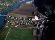
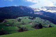
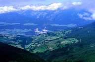
Pill is situated on the fan of the Pill Torrent, southwest of Schwaz in the Unterinntal Region. The dormitory town of Pill encompasses the centre along the federal road, the scattered villages of Pill-Niederberg and Hochberg on the northern slopes of the Kellerjoch Mountain. These villages are characterized by numerous new developments. The bottom of the valley became fertile agricultural land, after the Inn River with its boggy land had been regulated in the late 18th and 19th century.
|
|
|
|