Image collection »Mayrhofen«
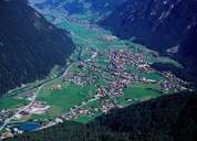
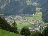
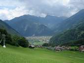
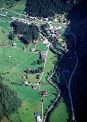
The market town of Mayrhofen is the largest settlement at the end of the Zillertal. South of Mayrhofen the four hanging troughs (so called "Gründe") Stillup, Floite and Gunggl with their numerous alpine pastures are to be found. The permanent settlement of Ginzling is situated in the so called Zemmgrund east of Mayrhofen within the Zillertaler Alps. Mayrhofen with the terminus of the Zillertal Railway is dominated by tourism. Originally people came to Mayrhofen to spend their summer holidays there or to go hiking in the surrounding mountains. Today tourists come in summer and winter, and for congresses held in Mayrhofen. According to statistics Mayerhofen, with its 1.3 million overnight stays, comes second in the Tyrol. Tourism related infrastructure, such as trade-, industry- and service orientated businesses are to be found in Mayrhofen. The energy sector with the Stillup Reservoir and the power station Mayrhofen plays another important role.
|
|
|
|
|
|