Image collection »Hainzenberg«
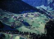
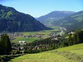
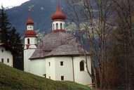
Hainzenberg (900 m) is situated on the north-eastern slopes at the entrance of the Gerlostal. The settlement with hamlets and detached farmhouses is concentrated on the gentle slopes along the road, towards the Gerlos Pass. Hainzenberg is located high above the deep gorge of the Gerlos Torrent. In former times Hainzenberg had its heyday with the gold-mining industry. Today most of its population has to commute to other villages. The pilgrimage church of Maria Rast, many tunnels and a goldmine adapted for visitors remind one of the "golden past". Since the building of a cable railway in 1960, the Gerlosstein skiing area has been one of the oldest in the Zillertal.
|
|
|
|