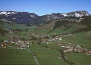
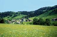
Image collection »Schattwald«
Schattwald is the last village in the Tannheimertal and is situated directly at the gentle incline to the state frontier on the Oberjoch. Schattwald is surrounded by gentle slopes with high alpine pastures. It has no real centre and is subdivided into some smaller villages and hamlets. The houses with their shingled weather sides (facing westward) and the living rooms facing eastward are remarkable. The power station in Schattwald provides enough energy for the entire valley.
|
|
|