Image collection »Reutte«
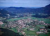
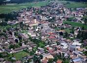
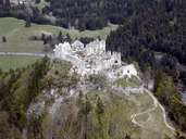
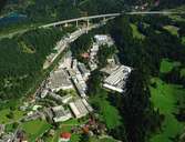
The market town of Reutte (since 1489) is situated in the centre of the Reuttener Basin. Reutte, which has never received a city charter, is the largest settlement in the Außerfern region with infrastructure of regional importance. Situated at a once important transit route, Reutte became an important centre for the salt trade with the area around Lake Constance and Switzerland, after a bridge over the Lech River had been built in 1464. This was the time when Reutte experienced its economic heyday. Today Reutte's economy is based on the Plansee Metalwork (famous for its powder metallurgy), which was founded in 1921 and employs more than 5000 people worldwide. The settlement is characterized by the long road in north-south direction with its houses in a south-German architectural style and a cluster of infrastructural facilities of regional importance. During the period of industrialization most of the recent developments, such as Südtiroler-, Tränke-, Schwarzkopf- and Archbachsiedlung, were built. The ruin of Castle Ehrenberg is also located in Reutte.
|
|
|
|
|
|
|