Image collection »Pinswang«
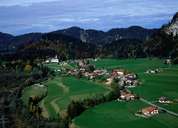
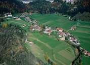
Pinswang is situated in a basin-like gap east of the Lech River, north of Reutte. The village consists of Ober- and Unterpinswang. Unterpinswang with its striking parish church, which was built by baroque architect Johann Fischer aus Füssen on a hill, forms the centre. Till 1782 traffic went through the village, following the medieval road, which was built on the Roman Via Claudia Augusta.
|
|
|