Image collection »Höfen«
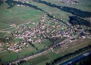
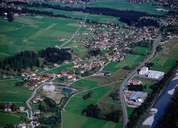
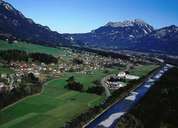
Höfen, southwest of Reutte, is situated on the left bank of the Lech River. Before the bridge was built in 1464, Höfen was more or less important for the ford to the opposite Ehenbichl. The originally separate villages of Höfen, Unter- and Oberhornberg and Platten have formed a wide ribbon-shaped settlement unit. Besides being a production site of a CD-company, Höfen is a commuter village. Höfen has a bypass road and the district's only air field (in 1956 originally built for gliders but today used for small planes too). The Reuttener Bergbahnen Funicular link Höfen with the skiing and hiking area of the Reuttener Hahnenkamm Mountain with its alpine flower garden.
|
|
|
|