Image collection »Hinterhornbach«
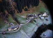
Hinterhornbach is situated in the Hinterhornbachtal which is the only inhabited valley in the Allgäuer Alps. The former detached farmhouse settlements have grown into hamlets along the 4 km long road from Vorderhornbach. The small village suffered from the migration of its people in the 1950's and 1960's. This trend has been stopped by the development of the road and several other means. Hinterhornbach is a very popular starting point for mountain tours in the Allgäuer Alps and for the striking summit of the Hochvogel Mountain.
|
|