Image collection »Häselgehr«
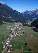
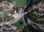
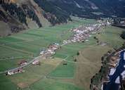
Häselgehr in the upper Lechtal is situated at an altitude above 1000 m. Compared to villages further down the Lechtal, Häselgehr is a large village consisting of several smaller villages and hamlets which form a belt of loosely connected settlements along the Lechtaler Straße Road. Despite Häselgehr's size, there are only a few businesses to be found in the village. In winter, Häselgehr is well protected by a great number of avalanche barriers on the northern slopes of the Häselgehrer Heuberg Mountain. Because of its fertile marl layers, alpine pasture lands can be found up to the summit.
|
|
|
|