Image collection »Bichlbach«
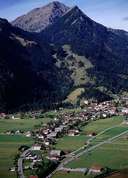
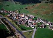
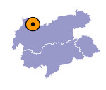
The village of Bichlbach is subdivided into the long stretched settlement of Bichlbach and the two settlements of Wengle and Lähn along the road. Lähn (1112 m), situated at the watershed of the valley, was called Mittewald till 1456 when an avalanche destroyed the village. Till 1816 Lähn used to be the border between the dioceses of Augsburg and Brixen. Until 1859 Bichlbach was the seat of the bricklayer and carpenter guild. Every year before the bricklayers and carpenters went off on their journeys they met in the guild church in Bichlbach. Today this recently renovated baroque church is the only guild church in Austria. The Mähberg Mountain, the symbol of the region, used to be pasture land up to its summit.

|

|
|
