Image collection »Schlaiten«
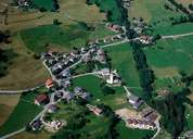
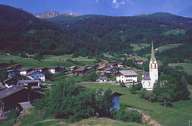
Schlaiten is situated in the lower part of the Iseltal and stretches from the Isel River southwest till the crests of the Deferegger Mountains. Houses can be found from the bottom of the valley up to 1200 m above sea level. Most of the village cannot be seen by transients. Schlaiten is subdivided into numerous hamlets, isolated farmhouses with mostly Slavic names, and the central village of Schlaiten and Mesnerdorf respectively. They are all situated 150 m above the bottom of the valley, on a terrace, which is divided into several segments by rivers, on the shady side of the valley. Even though agriculture still plays an important role within the village, most of the people have to commute to work outside Schlaiten.

|

|
|
