Image collection »Prägraten a.G.«
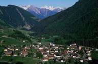
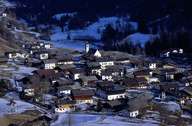
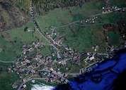
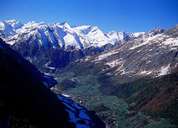
Prägraten is situated within the Hohe Tauern National Park, south of the main chain of the Hohe Tauern Mountain Range. It encompasses the centre of the valley behind the Isel Gorge, the upper part of the Virgental with several villages, hamlets and isolated farmhouses on the sunny slopes. Besides Prägraten (or St. Andrä), which forms the centre of the village, the hamlet of Hinterbichl is well-known for being the starting point to the famous Umbalfälle Waterfalls. Prägraten is characterized by marginal farming and sustainable tourism. It is a popular centre for mountaineering at the foot of the Großvenediger Mountain and a starting point for nine unique high-valleys with numerous shelters and alpine huts.
|
|
|
|
|
|