Image collection »Nikolsdorf«
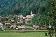
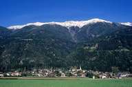
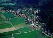
Nikolsdorf is not only the most eastern village in East-Tyrol, but from the entire province. East of Nikolsdorf the so called "Kärntner Tor", a narrow part in the Drautal, forms the border between the provinces of Carinthia and the Tyrol. The village encompasses three scattered villages on fans north of the Drau River: Lengberg in the west with the castle (which was once the seat of a judge), and Nörsach in the east of the centre Nikolsdorf with its impressive parish church. Since the Drautalstraße Road was built closer to the Drau River some decades ago, the bulk of the traffic no longer goes through the village. Isolated farm houses are scattered on the slopes of the Kreuzeckgruppe Mountain Range.
|
|
|
|