Image collection »Kartitsch«
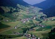
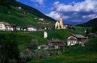
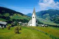
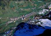
Kartitsch can be reached over a steep ascent from the Drautal. The village reaches up to the Kartitscher Saddle and encompasses the so called Tyrolean Gailtal (with the continuation to the Lesachtal in the east). Originally Kartitsch consisted of several hamlets and isolated farmhouses, which nowadays form an agglomeration due to recent developments. Kartitsch is situated in the lower part of the valley, divided through the steep valley of the Gail Torrent, on gentle terraces on both sides of the valley (Hollbruck with its well visible pilgrimage church on one side and St. Oswald on the other). Due southeast in the centre of the valley, one can find the centre of Kartitsch. Local economy is based on agriculture and timber industry as well as soft tourism.
|
|
|
|
|
|