Image collection »Kals a.G.«
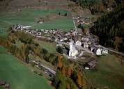
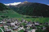
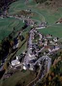
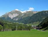
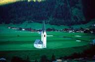
The village of Kals is situated within the Nationalpark Hohe Tauern. Kals encompasses the entire Kalser Tal and stretches from the Iseltal to the Kalser Tauern Mountain Range. Kals consists of several villages, hamlets and isolated farmhouses, built in the typical architectural style for this region, with their stone-built ground floors, wooden top floor with its ornamented balconies and gables. After the several kilometres long gorge of Staniska, the valley widens between the villages of Lesach and Burg. Between them the two main settlements of Großdorf and Ködnitz (also known as Kals), where the local administrative centre is to be found, are situated. The economy of Kals is based on agriculture and tourism.
|
|
|
|
|
|
|
|