Image collection »Hopfgarten i.D.«
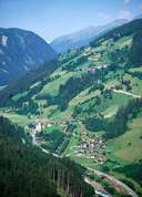
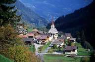
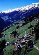
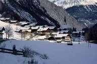
Hopfgarten in Defereggen is one of the three villages in the Defereggental. The village is situated behind the narrow part of the bed of the Schwarzach River. Hopfgarten can be reached on an inclining road from Huben. Hopfgarten - 6 km away from the Iseltal - is located on the sunny slopes of the valley. Before one reaches Hopfgarten, one goes through Dölsach, which stretches along the road. Following the road due west, one reaches the hamlets of Rajach, Hof and Plon with their detached farmhouses built in the region style, on the sunny slopes high above the bottom of the valley. Agriculture no longer plays the role it used to play. Only one fourth of the population still gains their living from farming.
|
|
|
|
|
|