Image collection »Ainet«
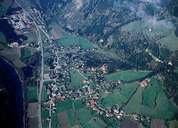
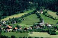
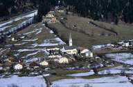
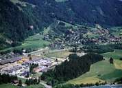
Ainet is situated in the Isel Valley in the northwest of Lienz. It consists of the former independent communities of Ainet, Gwabl and Alkus. Ainet is a scattered village with its old centre on the fan of the Daber Torrent. In the last few decades Ainet has grown along the bypass and a new industrial area has been developed between the road and the railroad. The settlement and the architecture of the farmhouses in Ainet differ significantly from the ones of the hamlets Gwabl and Alkus, which are situated on the slopes of the Schobergruppe Mountain Range up to an elevation of 1300 metres above sea level.
|
|
|
|
|
|