Image collection »Serfaus«
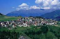
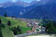
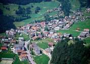
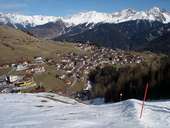
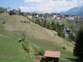
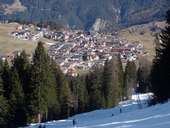
The long stretched settlement of Serfaus is situated on a gentle southwardly exposed slope of the Sonnenterrasse Plateau 500 m above the Inntal. The former mountain farming village has changed completely within the last decades. Today's Serfaus is characterized by hotels, private boarding houses and tourism related infrastructures. Since the development of the skiing area of the wide alpine pasture lands of Komperdell (up to 2500 m above sea level) around the Samnaun Mountain Range, Serfaus has turned into one of the leading centres for winter sports in the Tyrol. It furthermore has one of the highest figures of overnight stays in relation to the inhabitants (5000 guest beds and 1100 inhabitants). In 1985 Serfaus built a 1,5km long subway in order to reduce the traffic in the narrow streets in winter.
|
|
|
|
|
|
|
|