Image collection »Pettneu a.A.«
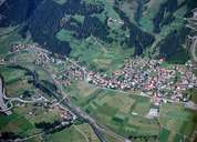
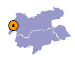
Pettneu am Arlberg is situated in the centre of the Stanzertal and is subdivided into several hamlets and the villages of Pettneu and Schnann with their farmhouses in the regional architectural style. Both villages are situated on the gentle slope of a fan facing south. In the Middle Ages Pettneu was an important centre for the traffic and the transportation of goods over the Arlberg mountain pass. It was furthermore the starting point for the mule track into the Lechtal and the Engadin. Next to cattle-breeding, dairy farming, and timber industry tourism is the main source of income in Pettneu, which is a popular region for winter sports especially among families with children.

|
|
