Image collection »Nauders«
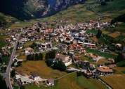
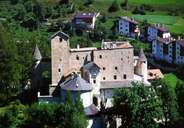
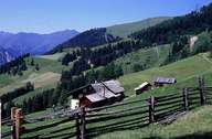
Nauders is situated on the northern end of the high valley of the Reschen Pass. The compact village centre together with Castle Nauders lies on the fan of the Gamor River. Nauders used to be the seat of a judge. In former times agriculture played an important role, which can best be seen in the many terraces, on which meadows instead of fields are to be found today. Tourism has a long tradition in Nauders, which reflects itself in the numerous old guesthouses, which once provided accommodation for the coachmen crossing the Reschen Pass. Since the second half of the 20th century winter tourism has led to a complete transformation and expansion of the village. Switzerland can be reached on a road over the Norberthöhe.
|
|
|
|