Image collection »Kaunertal«
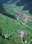
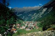
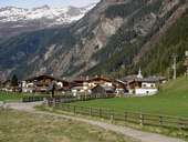
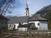
Kaunertal, with its centre in Feichten - the main village in the valley - , encompasses the entire narrow and barren U-shaped valley. Originally Kaunertal was characterized by hamlets. By the end of the 1950's the village went through a phase of economic upturn. The reason for that was the construction of the 6 km - long Gepatsch Reservoir between the years 1961 and 1964. The building of the 153 m high dam wall was controversial. A further impulse for the economy in the region was the development of the Weißseeferner as a glacier skiing area. In 1982 a panorama road was built connecting the skiing area at an altitude of more than 2700 m.
|
|
|
|
|
|