Image collection »Kaunerberg«
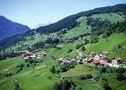
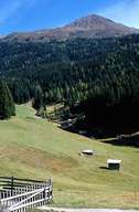
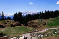
Kaunerberg with its isolated farmhouses and hamlets is situated in an extreme location high above the Kaunertal on an altitude of between 1300 m and 1500 m above sea level. The scattered village, including its centre Mairhof, is only linked with narrow roads. The southern slopes of the Kaunerberg Mountain belong to the driest places in the Tyrol. In the 1950's one therefore built a 13 km long system of channels in order to be able to irrigate the pasture land. One tried to stop the massive migration in the middle of the 20th century with special legal measures. One hopes that the creation of the Kaunergrad Nature Reserve will give the region an economic impulse and make it a centre for recreation. A small panorama road runs through the village up to the historically important Piller Saddle.
|
|
|
|