Image collection »Scheffau a.W.K.«
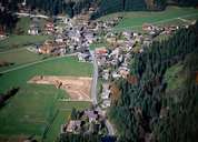
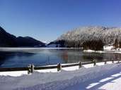
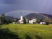
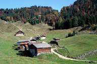
Scheffau is one of the four villages in the Söllandl region, a valley between Wörgl and St. Johann. Scheffau mainly consists of blaiken, in which larger farmhouses and new developments stretch along the road. It is furthermore subdivided into the village of Scheffau, which is situated away from the main road and the settlement around Lake Hintersteiner. The lake is located within a depression at the foot of the Wilden Kaiser Mountain. Since the beginning of the 20th century the lake has been used as a reservoir for a hydropower station at the Weißache River. After World War II the former rural village has transformed into a centre for tourism.
|
|
|
|
|
|