Image collection »Rattenberg«
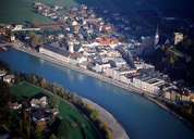
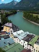
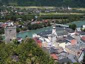
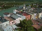
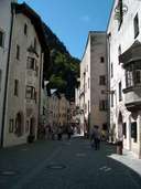
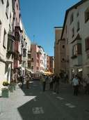
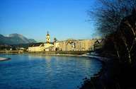
Rattenberg has the smallest surface area of all villages in the Tyrol. Its architecture is a typical example of a so called Inn-Salzach-Town (multi-storey buildings with oriels and the front facades facing the streets). Rattenberg was built between the rocks and the Inn river, at the foot of a ruin of a 10th century castle. In former times Rattenberg was a trade centre for the bateau shipping on the river and customs house at the border between Bavaria and the Tyrol. Most of the portals were made out of Kramsach marble and date back to the 15th century. Today Rattenberg is a centre for the glass industry. The historic gothic centre was long a narrow passage for the traffic from the west to the east. Today the centre is a pedestrian zone and the traffic goes on the tunnelled bypass or on the Inntal Highway.
|
|
|
|
|
|
|
|