Image collection »Breitenbach a.I.«
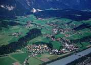
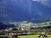
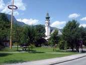
Today's Breitenbach with its boundaries including the centre Breitenbach and the scattered hamlets, has existed since the middle of the 19th century. In the course of the significant increase in population figures within the last few decades new settlements (i.e. Moos north of Breitenbach) have emerged. Formerly a farming community, Breitenbach gained importance through the bateau shipping on the Inn River. Today the name "Schopperwirt" indicates a workshop where bateaux were repaired. Most of the people in Breitnbach earn their living as employees or work on one of the 160 farms in the village. The parish church of St. Petrus is one of the oldest churches in the Tyrolean Unterland region.
|
|
|
|
Further links: Hazards Chronicle Tyrol, Weblink »Breitenbach a.I.«, Weblink »Wikipedia«, tiroLexikon