Image collection »St.Johann i.T.«
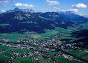
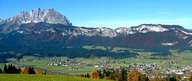
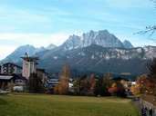
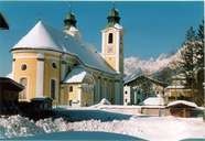
The market town of St. Johann in Tirol is situated in a wide basin within the Leukental between the massifs of the Wilden Kaiser in the north and the Kitzbühler Horn in the south. St. Johann is situated at the confluence of three rivers (Kitzbühler-Ache, Reither-Ache and Fieberbrunner-Ache), which form the Großache River. Because of its geographical position St. Johann is the most important traffic junction in the district of Kitzbühel. The centre with a number of baroque buildings is located 660 m above sea level between the rivers of the Kitzbühler- and Fieberbrunner-Ache. Within the last decades St. Johann has grown on both sides of the rivers and is about to form an agglomeration with the numerous hamlets in the valley.
|
|
|
|
|
|