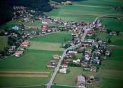
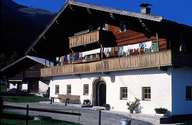
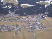
Image collection »Oberndorf i.T.«
Oberndorf (686 m) is situated in the Leukental, between the tourist centres of Kitzbühel and St. Johann. The municipality encompasses the village of Oberndorf and the hamlets of Eberhartling, Bichlbach, Haslach, Riesberg, Rerobichl, Schmiedboden and Wiesenschwang. The baroque parish church and the chapel of St. Nepomuk still remains on the mining in the area around Rerobichl. In the 16th century it was one of Europe's largest copper mining areas. In 1774 it was closed after mining accidents and a drop in revenues. Tourism and a quarry are the main sources of income in Oberndorf.
|
|
|
|