Image collection »Kössen«
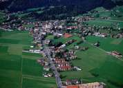
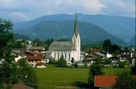
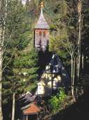
Kössen is situated in a depression between the Chiemgauer Alps in the north and the impressive Kaisergebirge Mountain Range in the south. Kössen consists of a loosely built-up scattered village and widely scattered hamlets with large isolated farmhouses typical for the Unterinntal region. Being the largest village with the highest population in the Kaiserwinkel region, Kössen is the central village with an infrastructure of regional significance. Tourism started to develop by the end of the 19th century and has boomed due to a large range of activities to be done in summer and winter since the 1960's. Apart from these recent developments full-time and half-time farmers still work in the agricultural sector. The programme for village regeneration in the Tyrol has started in Kössen in the late 1970's.
|
|
|
|
|
|