Image collection »Hochfilzen«
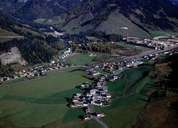
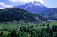
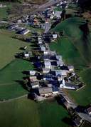
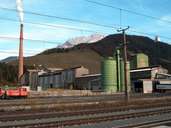
Hochfilzen, at the border to Salzburg, is the second largest of the four villages of the Lake Piller region. It is located on the Grießen Pass (970 m) from which rivers ran due north, east and west. In former times Hochfilzen was a scattered farming community within the march of Lake Piller. Soon after the railroad was built in 1875, a military training ground was established. Since the mid-1950's Hochfilzen has been characterized by magnesite mining and magnesite works. Situated within the Leoganger- and Loferer Steinberge Mountain Range and the Kitzbüheler Alps, Hochfilzen is famous for summer and winter tourism with a focus on Nordic skiing due to the considerable amount of snow that falls in winter in this region.
|
|
|
|
|
|