Image collection »Volders«
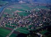
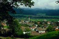
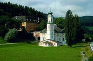
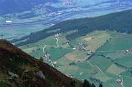
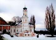
Within the last decades Volders has expanded extremely fast. Volders is subdivided into the settlement in the valley and the villages of Groß- and Kleinvolderberg on the eastern and western slopes of the unspoiled Voldertal. Around Castle Aschach and Castle Friedberg at the southern foot of the mountain, a park with numerous natural monuments is to be found. The popular Karlskirche church is an architectural particularity in the west of Volders . The church is the most beautiful rococo building in the Tyrol and can even be visited by transients from a parking space next to the Inntal highway. The so called "Himmelreich", a prehistoric settlement, belongs to Volders and Wattens. The fan on which Volders was built was the site of urn graves from the Bronze Age.
|
|
|
|
|
|