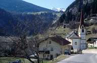
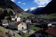
Image collection »Vals«
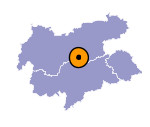
Vals encompasses the entire Valsertal, which disembogues into the Schmirntal at St. Jodok and has its entrance at Stafflach in the North-Tyrolean Wipptal. At the end of the valley, Vals reaches the peaks (some of which are higher than 3000 m) of the main crest of the Tuxer Alps. The centre of Vals is situated in the hamlet of St. Jodok with its parish church. St. Jodok has expanded significantly within the last decades. The Valsertal and the high valley of Padaun are dominated by isolated farmhouses and groups of farmhouses, which were developed in the High Middle Ages. In order to protect the biological diversity in the Valsertal for future generation, one created a nature reserve in the upper part of the valley.

|

|
|
