Image collection »Steinach a.B.«
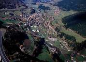
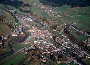
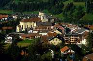
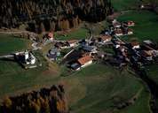
The market town of Steinach is situated in the northern Wipptal at the entrance to the Gschnitztal. Steinach is subdivided into the centre, numerous hamlets and isolated farmhouses. The village has expanded significantly due to new developments within the last years. Steinach's development into the largest village along the Brenner Road has been caused by its location at Europe's main axis of the traffic from north to south over the Alps. Traffic and the pollution it causes have increased since the second half of the 20th century. Since the construction of the Brenner Highway around Steinach in 1971, the quality of live has increased a little bit again. Steinach with its infrastructure of regional importance is the centre of the North-Tyrolean Wipptal. An organ builder has his company in Steinach. The funicular to the Berger Alm and a great number of hiking trails attract many tourists and people seeking recreation.
|
|
|
|
|
|