Image collection »Seefeld i.T.«
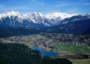
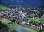
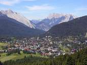
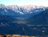
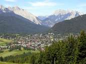
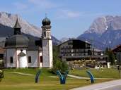
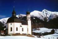
Seefeld is situated on a high plateau at an altitude of around 1200 m above sea level between Reith bei Seefeld and Scharnitz. Seefeld is surrounded by the Hohe Munde Mountain in the west, the Wetterstein Mountains in the northwest and the Karwendel Mountain Range in the northeast. Till the early 20th century people in Seefeld gained their living from farming, timber, or worked in the haulage business or sold stone oil. Since the construction of the Karwendelbahn Railroad 1910-12, the tourist sector has grown fast. Seefeld with a population of 3,000 has around 8.000 guest beds and 1,2 million overnight stays every year. A high class infrastructure and facilities are provided for tourists in summer and winter making Seefeld an important centre for tourism.
|
|
|
|
|
|
|
|
|
|