Image collection »Schönberg i.St.«
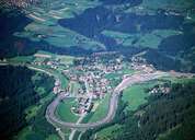
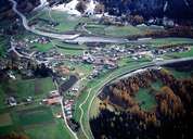
Schönberg im Stubaital is situated on a terrace between the Ruetz and Sill River. Schönberg stretches from Unterberg (800 m) till Gleins (1400 m). The scattered village of Schönberg (1013 m), which forms the centre, is surrounded by the Brenner Highway on three sides. Even though Schönberg has ever been a rural village, it has always played an important role for the traffic over the Brenner Pass too. In Roman times and in the Middle Ages the Brenner road went through the village. After the building of the Stefansbrücke Bridge in the 19th century the road with its 65 curves was built east of the village.
|
|
|
|