Image collection »Schmirn«
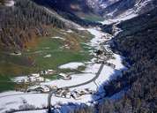
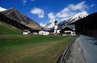
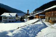
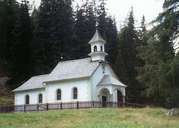
Schmirn is situated within the Schmirntal, an eastern valley in the northern Wipptal. Schmirn stretches from St. Jodok up to the crest of the northern Tuxer Alps and in the south till the area around the Olperer Mountain close to the main crest of the Tuxer Alps. The village is characterized by isolated farmhouses, which were built in the Middle Ages. Due to hereditary partition, these single farmhouses became groups of houses and a lot of small hamlets. Schmirn (1405 m) with its parish church, administrative centre and primary school with three classes, forms the centre of the village. Due to the late road development, traditional economies and ways of life have survived for a long time. Since the construction of the road in the 1970's, 90 % of the farmers commute and have a second occupation next to their farms.
|
|
|
|
|
|