Image collection »Rum«
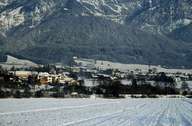
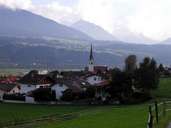
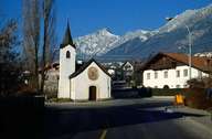
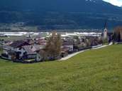
Rum is situated north of the Inn River, along the road bordering Hall with nearby Innsbruck in the west. The old scattered village, which was made into a market town in 1987, is situated on the large fan of the Rumer Landslide. After World War II Rum with its gothic parish church has grown significantly due to its proximity to Innsbruck. In "Neurum", which is located at the bottom of the valley, new dwellings, shopping centres, industrial and commercial enterprises have been built since the 1970's. "Hochrum" has been built in several stages above the village since 1955. Beside the residential area a private clinic belonging to a convent was built.
|
|
|
|
|

|
|