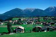
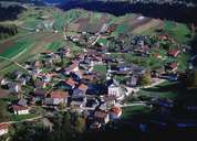
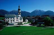
Image collection »Ranggen«
Ranggen, which is subdivided into Außer-, Ober- and Unterdorf, lies in a hollow on the slopes east of the Inzinger Mountain. It furthermore encompasses several compact settlements and hamlets, which characterize the cultural landscape. The Residence of Ferklehen, which lies at the bottom of the valley near Unterperfuss, is worth mentioning: it got its name from the word "Fergen", which means the right to operate a ferry on the Inn River near Zirl. When a bridge was built in 1482 the word meant the right to maintain the bridge.
|
|
|
|