Image collection »Pfons«
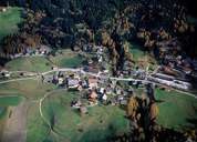
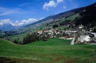
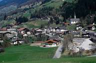
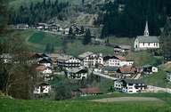
Pfons is situated on the right bank of the Sill River, close to Matrei am Brenner. The village was the starting point of the former Salzstraße Road running through Ellbögen, Patsch, Lans, Aldrans, and Ampass to Hall, which followed approximately today's provincial road. Serpentine was once quarried in Pfons and used for decoration in many churches in the Tyrol. After World War II the economic boom has led to a number of new housing developments. Pfons has turned from a rural community into a dormitory town with small commercial- and service-orientated businesses. Because of the proximity to neighbouring Mühlbachl and Matrei much of the infrastructure (schools, kindergartens, youth centres and sports fields) is shared.
|
|
|
|
|
|