Image collection »Pfaffenhofen«
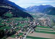
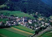
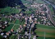
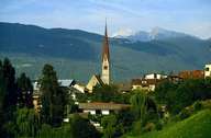
The scattered village of Pfaffenhofen is situated near Telfs, south of the Inn River, on the fan of the Bläh Torrent and at the foot of Mount Hocheder (2797 m). Excavations show that this area has already been settled during the Bronze Age. In the Middle Ages the Court of Hörtenberg, from which only ruins above the village are left, formed the centre of this region. In the 17th century the court was moved to Telfs and Pfaffenhofen lost its importance and became a rural settlement. Some commercial- and industrial enterprises were founded in Pfaffenhofen in the 19th century. Today Pfaffenhoffen and Telfs form one settlement, which is best seen in the railway station of Telfs, which is actually located in Pfaffenhofen.
|
|
|
|
|
|