Image collection »Mühlbachl«
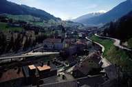
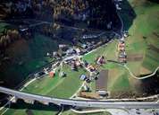
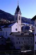
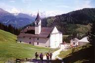
Mühlbachl, on the western slopes of the North-Tyrolean Wipptal, extends from the entrance to the Navistal to Schönberg. Mühlbach is closely linked with the market town of Matrei am Brenner, which was founded by the Bishops of Brixen in the Middle Ages on the land, which by then was part of Mühlbachl. The earliest traces of human settlements in the region are from the Stone Age. The Roman road from Matrei to Wilten went through Mühlbach, though one is not sure where exactly. Mühlbachl was long a farming community. The commercial enterprises were concentrated in the hamlets close to Matrei with its market of regional significance.
|
|
|
|
|
|