Image collection »Mieders«
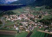
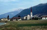
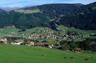
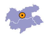
Mieders is situated on the right side of the lower Stubaital. The massive limestone formation of the Serles Mountain overlooks the gentle slopes in the south. Permanent settlement is concentrated on a wide terrace 950 m above the Ruetz Torrent that runs in a deeply cut river bed. The scattered village of Mieders has already existed in the early Middle Ages. Before Fulpmes became the centre of the valley in the course of the construction of the Stubaitalbahn tramway on the northern slopes in the 19th century, Mieders with its mining industry and court (till 1923) had been the centre.

|

|

|
|
