Image collection »Matrei a.B.«
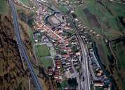
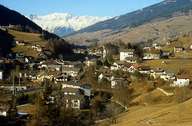
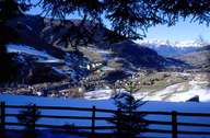
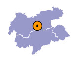
The market town of Matrei am Brenner, 17 km south of Innsbruck, is situated in the Wipptal and belongs to the political district of Innsbruck-Land. The compact settlement is characterized by impressive, beautifully ornamented houses of merchants and guest houses. Being the second smallest village in the Tyrol (35 hectares), Matrei is a centre for transit traffic. In the Middle Ages Matrei became important due to its geographical position at the junction between the road up the Brenner Pass and the Salzstraße Road from Ellbögen. During this time the market town was founded on the land formerly belonging to the village of Mühlbach. This caused the complicated boundaries between the villages of Matrei, Mühlbach and Pfons, which still share some of their infrastructure. The company of Gerätewerk Matrei belongs entirely to the employees working there.

|

|

|
|
