Image collection »Kematen i.T.«
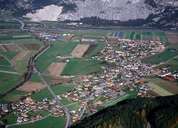
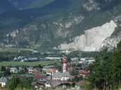
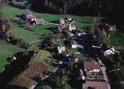
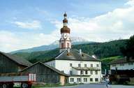
Kematen in Tirol is located on the fan of the Melach Torrent. Kematen with its hamlet of Afling is situated in the upper-Inntal, west of Innsbruck at the entrance of the Sellraintal. Kematen is a striving village in the Innsbruck area. The village is divided into an upper and lower part, clearly visible in the two different types of architecture, which reflect the former different social structures: the impressive farmhouses and the small houses of the poor. Several ovens and two detached granaries -dating back to the 14th century - in which the tithe was stored, show the former importance of the cultivation of cereals in the region. Today's economy is based on a large bakery and other business close to the railway station.
|
|
|

|
|
|