Image collection »Hatting«
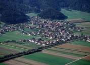
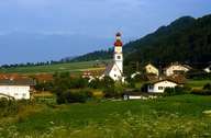
Hatting is situated on the southern slopes of the Inntal in the Oberinntal region between Inzing in the east and Polling in the west. In 1974 Hatting became an incorporated part of neighbouring Inzing, from which it regained its administrative independence in 1993. Hatting is a scattered village along the Salzstraße Road which runs from Kematen to Telfs. First mentioned in a document in the 11th century, Hatting's origin can be traced back till the early Middle Ages. In the last decades more and more commuters have moved to Hatting, causing the village to expand.
|
|
|