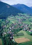
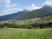
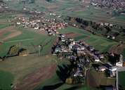
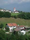
Image collection »Grinzens«
Grinzens is located at the edge of the western terraces above the Inntal and is divided into Ober- and Untergrinzens. The Senders Torrent runs along the border between Grinzens and Axams. The long stretched settlement of Neder (Neder = shadow side of the valley) together with the scattered settlements of Tafl and Brandegg, reach the border to neighbouring Sellrain (Rothenbrunn, Tanneben). Formerly Grinzens was dominated by the cultivation and production of flax and now presents itself as a commuter village. Life focuses in Untergrinzens where the parish church and school are to be found.
|
|
|
|
|
|