Image collection »Birgitz«
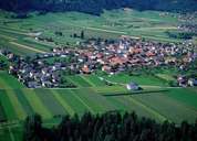
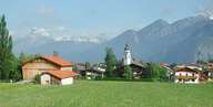
Birgitz, 7 km southwest of Innsbruck, is situated on a terrace under the Kalkögel Mountains. On the "Hohe Birga", a forested hill in the north, one found the oldest traces of settlements in the village, dating 100 years B.C. The centre of Birgitz along the main-road still has a rural character. Within the last decades the settlements of Birgitz and Götzens in the east have grown close together. Birgitz, like its neighbouring villages, has turned into a suburb of nearby Innsbruck with a high proportion of commuters.
|
|
|