Image collection »Sautens«
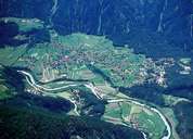
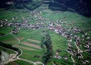
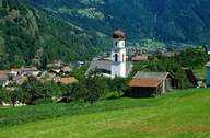
Sautens is situated away from the main street at the entrance of the Ötztal on the western side of the valley on two wide fans and stretches from the depressions of the Oberinntal up to the high mountains of the Ötztaler Alps. Sautens is subdivided into numerous parts with their long rows of houses form today's centre. The hamlet of Haderlehn also belongs to Sautens. Till 1833 the village administratively belonged to Oetz. Sautens" sunny and sheltered position has positive impacts on agriculture. This mild local climate is reflected on the village emblem, which shows three leaves and a swallow on a yellow and green subsurface.
|
|
|

|
|
|