Image collection »St.Leonhard i.P.«
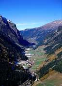
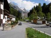
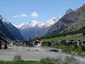
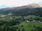
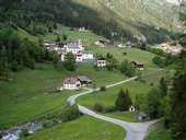
St. Leonhard is situated in the central Pitztal and encompasses around two dozens hamlets, stretching 25 km along the narrow bottom of the valley with its scanty soils. Till the 20th century the valley gained its income from livestock, dairy and the cultivation of flax. In the 19th century timber industry had to be stopped on the extremely steep slopes, because the number of avalanches and landslides had increased. Since 1982, when the Pitztaler Glacier became a skiing area, the region has started to focus on tourism, which has had an impact on the villages. The hamlet Mandarfen at the end of the valley has become a small hotel resort. Europe's highest funicular, the so called "Pitztal-Express", runs through a tunnel up to 3400 m above sea level.
|
|
|
|
|
|