Image collection »Mieming«
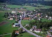
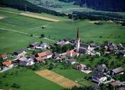
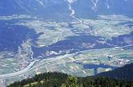
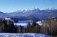
Mieming is situated in the centre of the Mieming Plateau, a terrace above the Inntal on the foot of the Mieminger Mountain Range with its white limestone walls, which extends from Telfs to the Holzleiten Saddle. Mieming is subdivided into numerous villages and hamlets with small farmhouses, which often have decorated gables and frescos on their walls. The settlement has expanded and has grown close to Barwies, because of the mild climate and the proximity to Telfs, the economic centre of the region. Many commuters live in Mieming, which is also very popular for second homes and people spending their retirement there. Mieming with its beautiful landscape is a popular recreation area.
|
|
|
|
|
|