Image collection »Imsterberg«
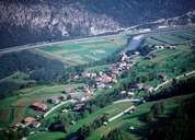
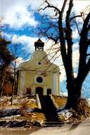
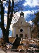
Old field-names clearly indicate that the area around Imsterberg has long been settled. Excavations in Hinterspadegg show the ruins of a watch tower of the Knights of Starkenberg. Imsterberg with its hamlets is situated on the north-eastern slopes of the Venet Mountain. Besides the late-baroque parish church, several chapels can be found in and around Imsterberg. The village of Imsterau - south of the Inn River - has the highest housing density in the village. Imsterberg gains its revenues mainly from agriculture, private distilleries and the hydropower station of Prutz-Silz.
|
|
|
|